 |
 |
|
|
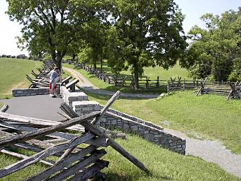
(7-02) Tour
Stop 8 (Sunken Road: Bloody Lane), view looking northwest. The road at
right leads to the Roulette Farm. The curve near the west end of the
Sunken Road is in the background. 2002 NPS Tour Guide: For nearly 4
hours, Union and Confederate infantry contested this sunken country road,
resulting in over 5,000 casualties. Thus the name "Bloody Lane" |
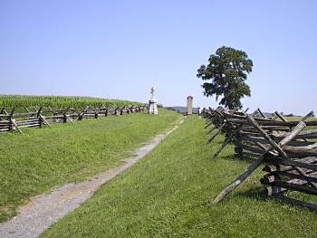
(7-02) Tour Stop 8 (Sunken Road: Bloody Lane). View looking southeast toward the observation tower near the east end of the Sunken Road |
|
 |
 |
|
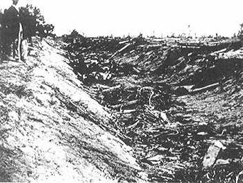
| (2 days after the battle) Confederate dead in the Sunken Road |
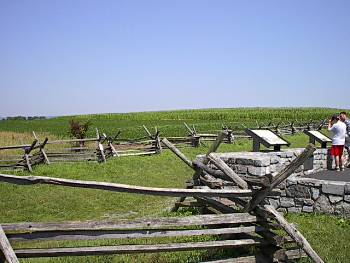
(7-02) Tour Stop 8 (Sunken Road: Bloody Lane), view looking east from point a few yards east of Roulette Farm Road |