|
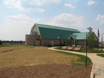
(July 2007) Opening
officially on June 27, 2007, the new visitors center was designed to blend
into the landscape and surroundings. It is located on the north side of
the battlefield, off the Georgetown Pike (Maryland Highway 355).
Resembling a barn with attached silo, the first floor has services and the
ranger desk. Interpretive and interactive exhibits are on the second
floor, including an electronic map and narrative of the battle. A viewing
deck, accessed from the second floor offers a sweeping view of the
Monocacy River Valley. Several major landmarks of the battle - Monocacy
Junction, the bridges, Best Farm, Gambrill Mill, and Sugarloaf Mountain -
are visible
Photo by Craig Swain |
|
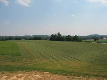
(July 2007) From the viewing deck of the Visitors Center looking to the
south. Working from left to right, the tree line just blocks the view of the
Baltimore and Ohio Railroad grade, and where it intersects with the
Frederick spur creating Monocacy Junction. Further towards the center, where
Georgetown Pike crosses the Monocacy River, at the time of the battle stood
a covered wooden bridge. In the far distance beyond the largest group of
trees, is Sugarloaf Mountain, site of a signal station during the war.
Lastly on the far right is the Best Family Farm
Photo by Craig Swain |
|
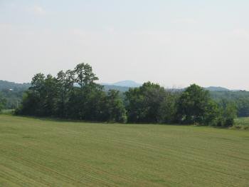
(July 2007) Closer view of Sugarloaf Mountain. This monadnock mountain
featured in the movements for the Battle of Balls Bluff, the Antietam and
Gettysburg Campaigns, and finally Early's 1864 raid. It is the highest
terrain feature in the area east of the Catoctin Mountains, and affords a
view south as far as Manassas. Federals maintained signal stations on the
crest for most of the war, which reported Lee's Potomac crossing in
September 1862, Early's advance here in 1864, and many activities of
irregulars such as Mosby. The crest is visible from most of the
battlefield, and serves as a good point of reference for the battlefield
explorer
Photo by Craig Swain |
|
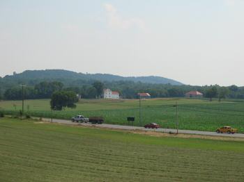
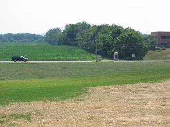
(July 2007) View of the Best Family Farm. The house and outbuildings are stop
one on the driving tour. Although the house is generally not open for
visitors, the grounds are now open (having been closed off for periods in
the past). Behind the farm runs the Monocacy River. Still further behind,
the wooded hill rising in the background is Brooks Hill, which concealed
Gordon's Division after they forded the river
Photo by Craig Swain |
|
(July 2007) Monocacy
Memorials
 Close-ups of the memorials: Courtesy of Mike
Stroud, Bluffton, SC
Close-ups of the memorials: Courtesy of Mike
Stroud, Bluffton, SC
Across the busy Georgetown Pike is a set of memorials to the
battle. The treeline is not historically accurate. Instead a grove of
trees covered the now open field from roughly where the monuments are,
down to the Best Farm road, and several hundred yards back of the Pike.
The initial fighting on July 9, 1864 in this sector occurred here, as
Ramseur's Division advanced down the Pike and encountered a mixed group of
Federal cavalry and infantry skirmishers intent on delaying the advance
Photo by Craig Swain |
|
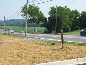
(July 2007) From the entrance to the visitors center, looking south down the
Pike, Ramseur's men advanced against the Federal skirmish line spread from
the river's bend (to the east of the visitors center) through the Best Grove
(which stood in what is now the open field behind the memorials
Photo by Craig Swain |