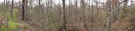
1. Austin
Creek Ravine, 400 yards north northwest of the Crossroads |
| |
2. Wartime
Southern Railroad of Mississippi in Bolton |
| |
3. Bowen's
escape route west of Raymond Road crossing of Bakers Creek |
| |

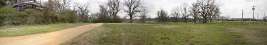
4. Champion Hill Missionary Baptist Church (360) |
| |

5. Coker
House
Ridge, north of Coker House (360) |
| |
6. Coker
House Ridge, south of Coker House |
| |

7. Crest of Champion Hill (360) |
| |

8. View from
crest of
Champion Hill (360) |
| |
9. East side
of Champion Hill crest |
| |
10. Terrain
east of Jackson Road, 400 yards south of Champion House site |
| |
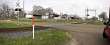
11. Edwards |
| |

12. Jackson
Road 400 yards south of Champion House site (360) |
| |

13. Ridge
overlooking Jackson Creek Bridge on Raymond Road (360) |
| |

14. Jackson
Road and knoll approximately 300 yards south of Champion House site
(360) |
| |
15. Lee's
Ridge, 1/4 mi. north northwest of Champion Hill crest |
| |
16. East
approach of Champion Hill, 160 yards north northeast of crest |
| |
17. Terrain
200 yards north of Champion Hill Crest, west of Jackson Road |
| |
18. Terrain
200 yards north of Champion Hill Crest, west of Jackson Road |
| |
19. Looking
toward Lee's Ridge from a point 800 yards north northwest of Champion Hill
Crest |
| |
20. View from
Ratliff Ridge, 1/4 mi. southwest of I. Robert's House site |
| |
21. Ratliff
Plantation Road from I. Robert's House site |
| |
22. I.
Robert's House site |
| |
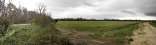
23. Turkey
Creek Bridge looking west |
| |
24. Behind the Yeiser House (Hiawatha) and Loring's escape route |
|
|
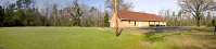
25. Champion House site |
|
|
26. West face of
Champion Hill approximately 50 yards north
northwest of crest |
|
|
27. West face of
Champion Hill approximately 50 yards north
northwest of crest |
|
|

28. The Crossroads (360) |
|
|
29. Looking toward Lee's Ridge from a point 1000 yards northwest of
Champion Hill Crest |
|
|
30. Ridge west of Jackson Creek Bridge on Raymond Road |
|
|
31. Jackson Road and area west
of Champion Hill Baptist Church |
|
|
32. Area south of Champion Hill Baptist Church |
|
|
33. Area south and east of Champion Hill Baptist
Church |
|
|
 |
|
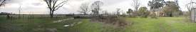
34. Area northeast of the
Crossroads |
|
|
 |
|
35. Area northeast of Champion
House site |
