|
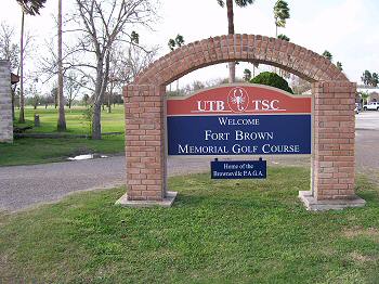
(12-2006) This
photo shows the University of Texas Brownsville (formerly Texas Southmost
College) Golf Course. The golf course is located in the interior of Fort
Brown. This is a site famous from the Mexican War and important in the War
Between The States
The following information was taken from the Handbook of Texas
"In 1860 Robert E. Lee was stationed at Fort Brown on assignment to quell
border disturbances. The post was abandoned by United States troops in
March 1861 and occupied by troops of the state of Texas. Fort Brown was
garrisoned by a small force of Confederates until November 1863. On the
approach of Union forces, the Confederates retreated and burned all stored
cotton and the fort buildings. Union forces occupied the fort until July
1864, when it was again taken by Confederates forces, who held it until
November 1865. During Confederate occupation the fort was described as a
field work of six bastion fronts with a defense line of 950 yards
garrisoned by 2,000 men with an armament of guns of different calibers.
The fort was reoccupied by federal forces after the Civil War, again as a
protection against Mexican invasion." |
|
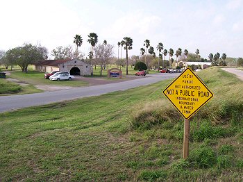
(12-2006) This
photo shows the interior of Fort Brown. The site is now a golf course on
the University of Texas Brownsville campus. It is also directly across
from the Mexican city of Matamoros and, as such, is located in a zone
heavily patrolled by the US Border Patrol. I stopped to take this picture
and literally within seconds the US Border Patrol was around me |
|
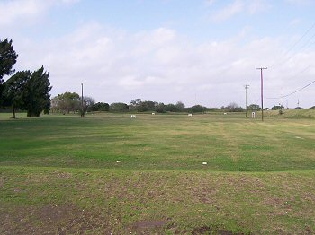
(12-2006) This Photo shows the
original bastion of Fort Brown. Due to intense security along the border,
this was as close as I could get on Dec 28, 2006
At the left end of the driving range of the golf course a cannon can be
seen. This cannon is a marker in an original bastion of Fort Brown where
Major Brown was mortally wounded during the Mexican War (1846-1848). The
earthen bastion still exists and is part of a levee along the Rio Grande.
Much of the rest of the original earthen walls of the fort have long been
destroyed but this stretch remains.
Look carefully at the 250 marker on the driving range and you will see the
remains of the bastion and earthen wall from the interior of Fort Brown |
|
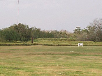
(12-2006) Close-up of the cannon
and bastion shown in previous photo |